
- cross-posted to:
- news@beehaw.org

- cross-posted to:
- news@beehaw.org
The magma chamber threatening the grindavik area has erupted again just before 8:00am.
You must log in or register to comment.
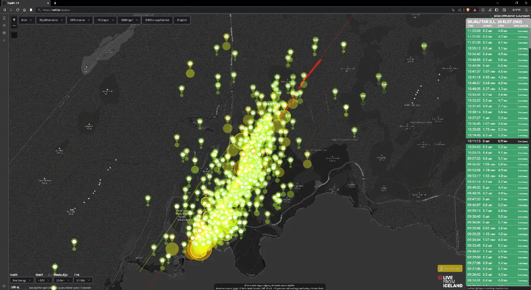
A map plotting the 569 earthquakes (and still counting over the last 24 hours). These are mostly centered around the magma intrusion.
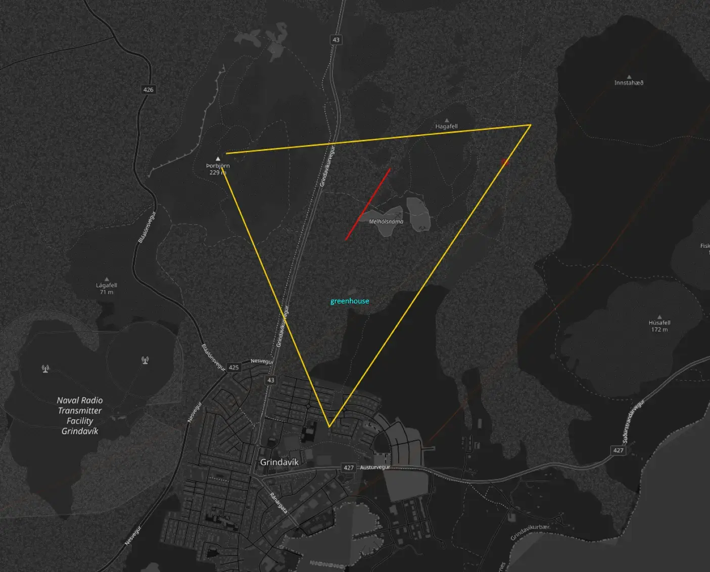
At 7:57am, the fissure opened. Whereas last time the fissure opened up far to the north and east of Grindavik, they were not so lucky this time. The fissure has now spread much more south in the Hagafell region. It seemed to me as though it erupted at the southern end of the fissure that erupted in December. At the time of this post (11:00am), magma is only a few hundred feet from the greenhouse and maybe a mile from Grindavik.
A considerable portion of the rift spread under the protective berm they created over the last few weeks. While the berm was effective (Think sandbags stacked up to stop flood waters, but with dirt and stone), It could only ever stop a certain amount of liquid flow. This spreading of the fissure effectively circumvented it’s protection for areas of the fissure inside the berm. The best case scenario now is that the southern end of the fissure ceases and cools before it can eject enough matter to overwhelm the town, which is now downhill.
Send hope that Grindavik and it’s populace are spared. This is close to a worst case scenario.
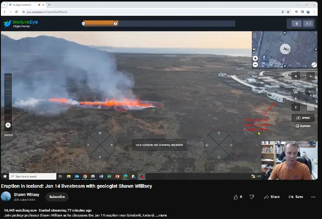
A close up view frown Professor Shawn Willsey’s livestream showing just how close the southern fissure is to town. This was taken a few hours ago via ariel drone. The vent opened in real time while the drone was flying and observing the northern rift.
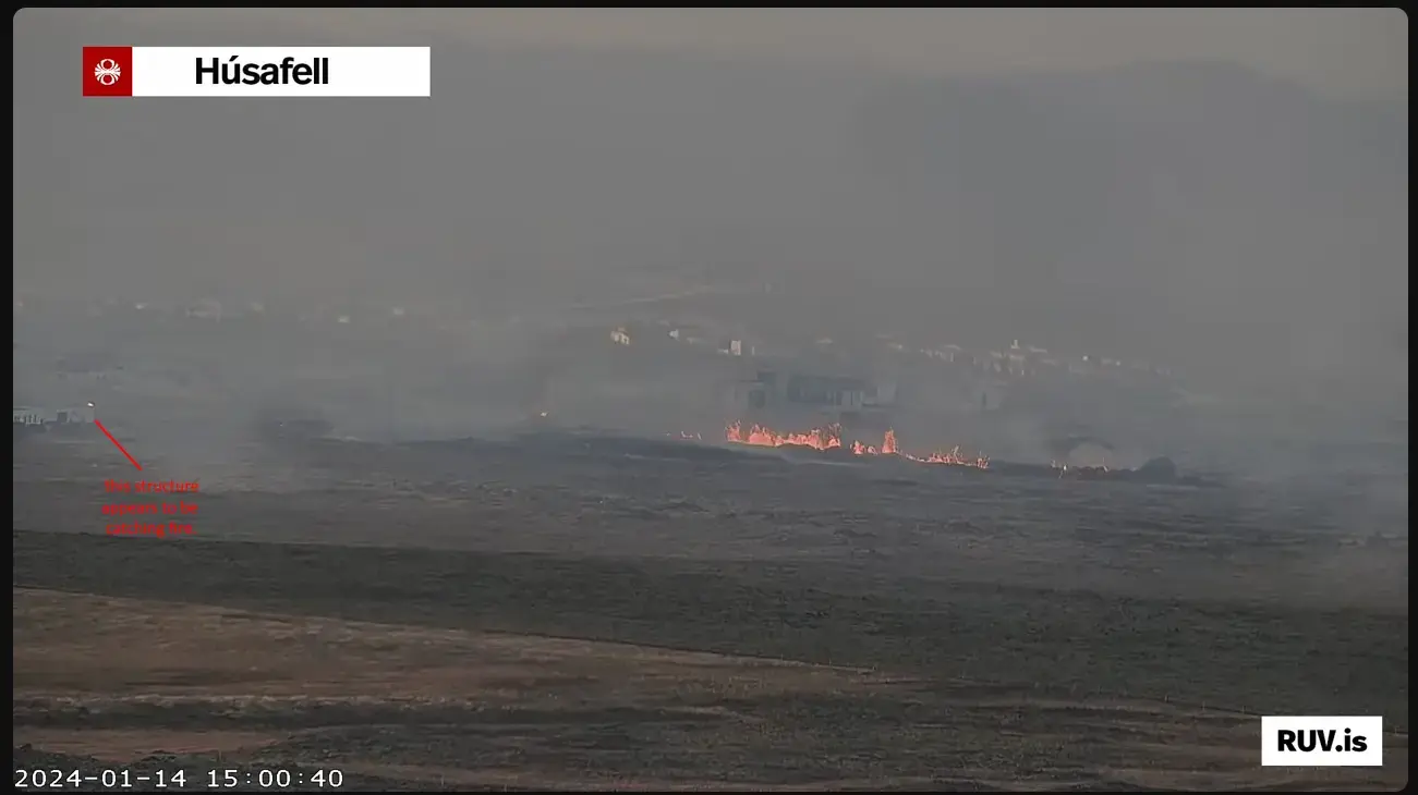
A few hours later, a structure in northern Grindavik closest to the southern fissure appears to have caught on fire.
If there is any good news to be found, the eruption appears to have lost a bit of its initial thunder.
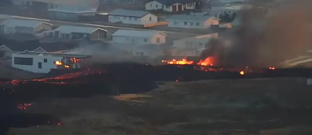
A closer view of the initial damage. This could very well be the beginning of the end for Grindavik.
It noteworthy to mention that the town has been evacuated and the people are not in harms way, but this was likely someones home. My heart breaks for you folk.
If you are looking at camera 4 (yellow), the camera is situated atop porbjorn looking west and a bit south. The red lines are an approximation of the rift. The building near center frame becoming surrounded by lava is their greenhouse. Town is at the right.
Edit: My line is drawn incorrectly. It is a bit more west on the other side of Hagafell.
What’s home insurance like in Iceland?
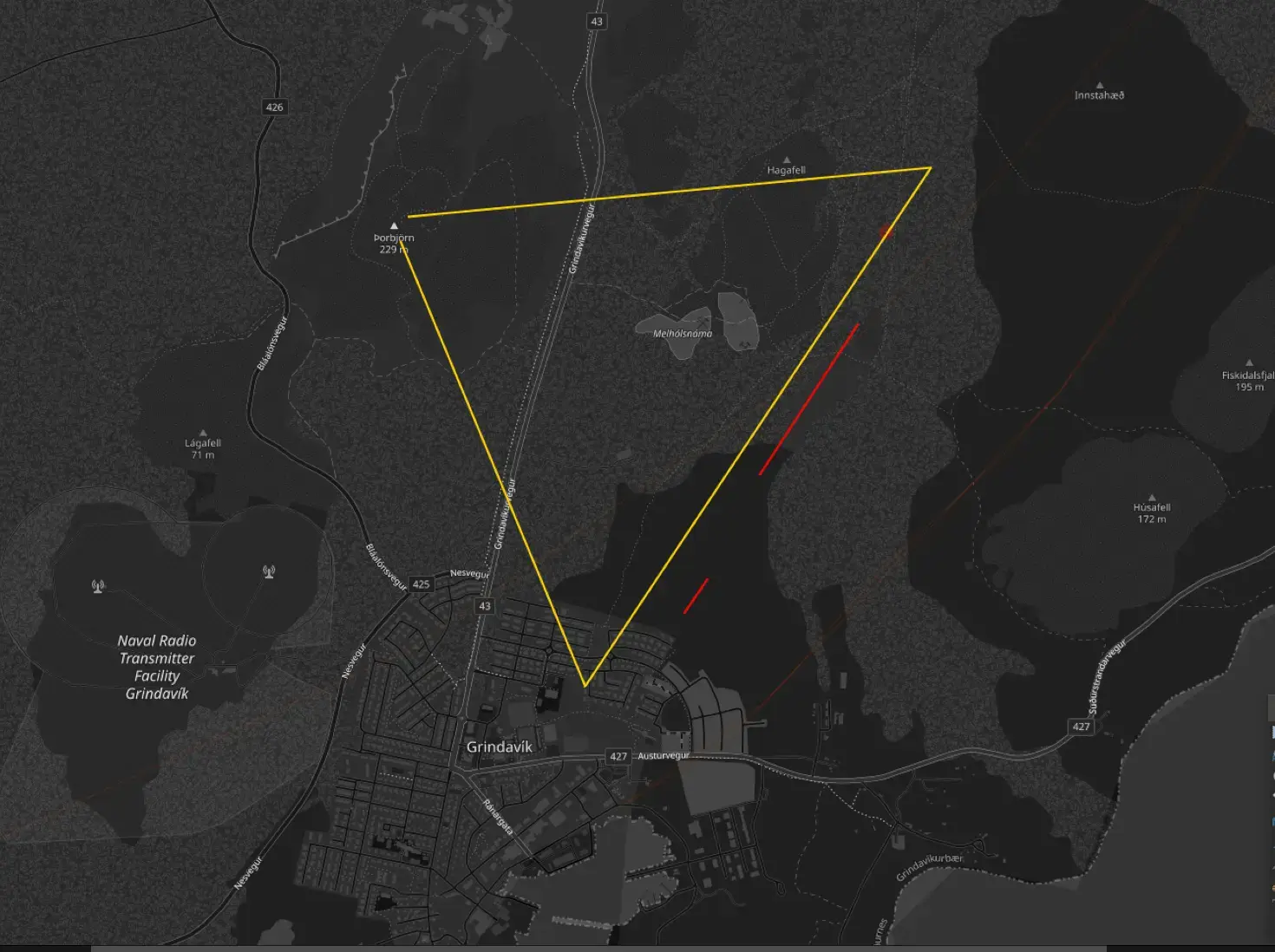
An updated map of the fissure. Additionally, a new vent has opened in town. This is not good
Here is an alternative Piped link(s):
https://piped.video/watch?v=804nPrAUAxg&ab_channel=LivefromIceland
Piped is a privacy-respecting open-source alternative frontend to YouTube.
I’m open-source; check me out at GitHub.
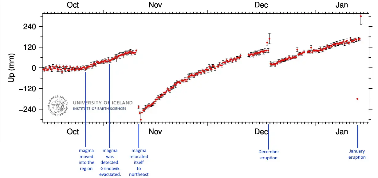
A map of land elevation for the Svartsengi region during the campaign of this particular magma intrusion event.
Here is an alternative Piped link(s):
Live coverage from an actual geologist Shawn Wilsey
Piped is a privacy-respecting open-source alternative frontend to YouTube.
I’m open-source; check me out at GitHub.
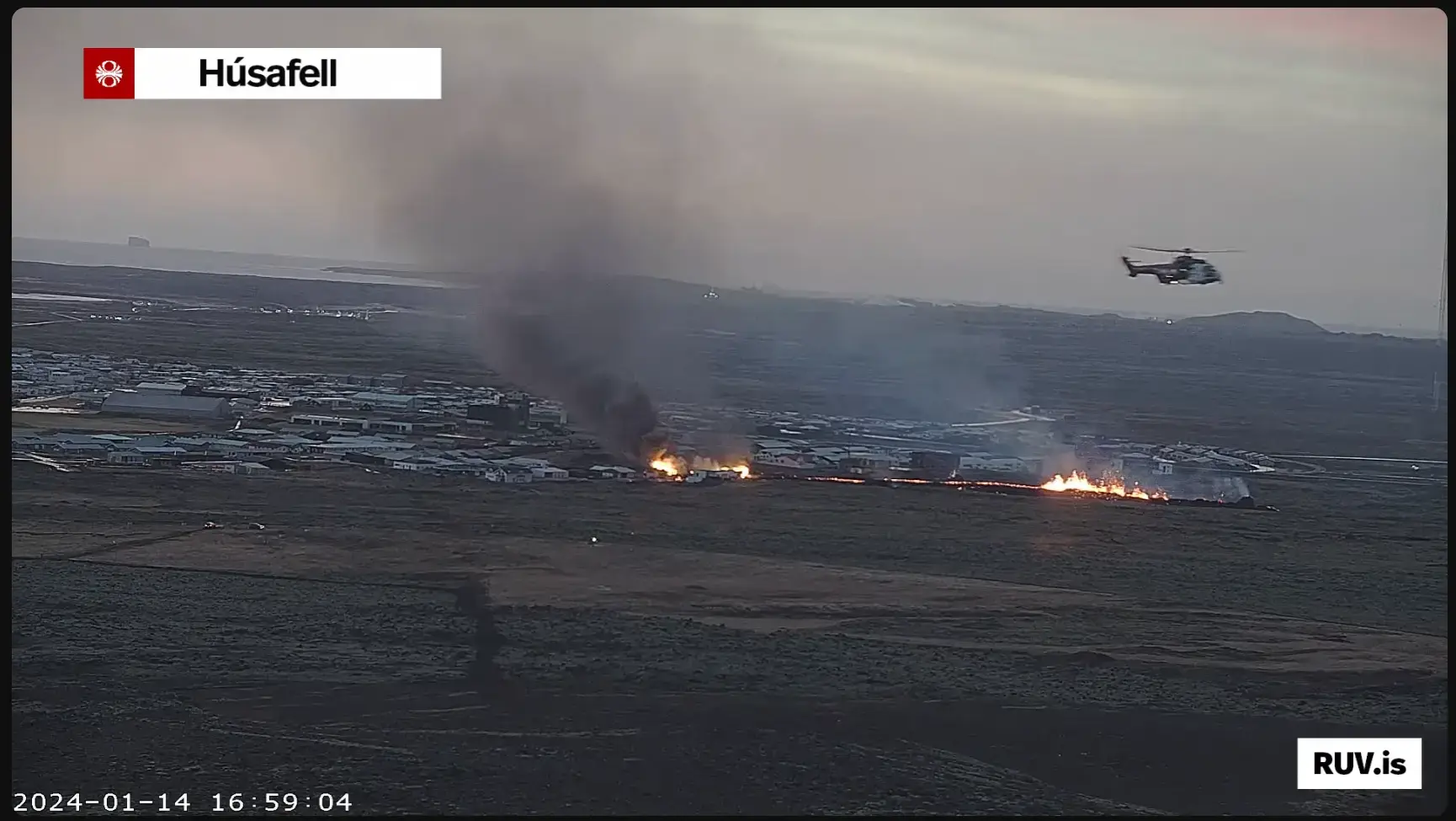
Either a third fissure has opened (there is a mini-cluster of larger magnitude quakes in his area), the second fissure has extended into town, or more homes are catching on fire. It’s getting hard to tell which due to the volcanic gasses (White), smoke (Black) and just the darkness of winter.
There was a another mini-cluster of earthquakes further to the south edge of town as well. With it’s proximity to the sea it will cause a severe amount of damage.
I feel this is a historic event. I’m also a refractory designer, which places this squarely in my realm of interest, but it’s heartbreaking to have to watch in slow motion. This would be very cool if it were not for the human element present in these conditions.
